geo-hist
HISTORICAL DIAGRAMS
The Cartography and Geospatial Data Section of the Hellenic Statistical Authority, utilizing the historical map archive of past population-household censuses, created the application "HISTORICAL POPULATION CENSUS DIAGRAMS". The app allows the visitor to select diagrams from the years 1958, 1961, 1971, 1981 and 1991 where available. Also the visitor can select diagrams from the year 2001 in digital form.
In the application the user can :
- choose the background of his liking,
- add layers using the app's available mapping services,
- draw polygons - lines - points of interest with the toolbox and
- export the map in PDF, JPG, etc.
hist
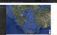
To go to the historical charts application, click on the relief map.